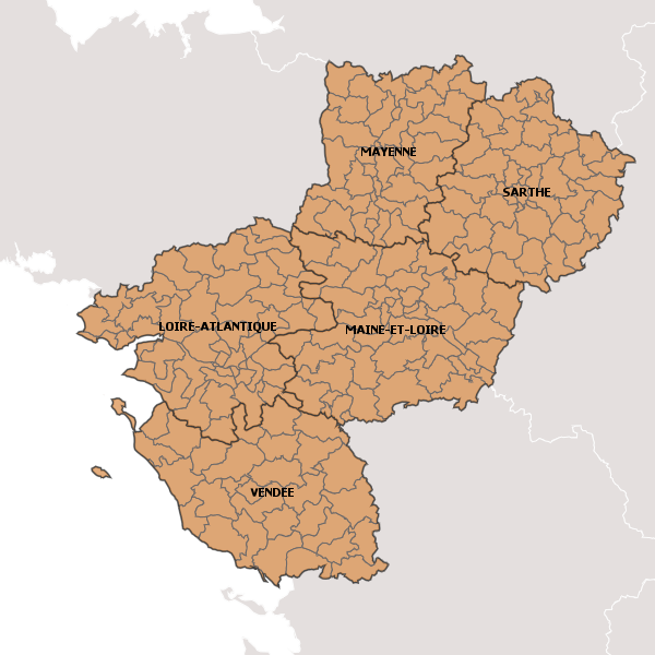
test_canton_carto
test
Simple
- Date (Publication)
- 2018-05-17T00:00:00
- Date (Creation)
- 2018-05-17T00:00:00
- Date (Revision)
- 2018-05-17T11:51:14
- Theme
-
- test
- canton
- test
-
- PAYS DE LA LOIRE
- Keyword
- BD Carto IGN
- Type
- Theme
- Date (Publication)
- 2024-03-25
- Unique resource identifier
- geonetwork.thesaurus.external.theme.prodige
- Access constraints
- Restricted
- Use constraints
- Copyright
- Other constraints
- Pas de restriction d’accès public selon INSPIRE
- Spatial representation type
- Vector
- Denominator
- 1000000
- Metadata language
- fre
- Topic category
-
- Location
- Description
- Région Pays-de-la-Loire
N
S
E
W
))
- Begin date
- 2018-05-17T00:00:00
- End date
- 2018-05-31T00:00:00 After
- Reference system identifier
- EPSG / RGF93 / Lambert-93 (EPSG:2154) / 7.4
- Distribution format
-
-
ZIP
(
{{format_version}}
)
-
ZIP
(
{{format_version}}
)
- OnLine resource
-
test_canton
(
OGC:WMS-1.1.1-http-get-map
)
test_canton
- OnLine resource
-
test_canton
(
OGC:WFS-1.0.0-http-get-capabilities
)
test_canton
- OnLine resource
- Accès au téléchargement des données ( WWW:DOWNLOAD-1.0-http--download )
- OnLine resource
- Accès à la visualisation des données ( WWW:LINK-1.0-http--link )
- Hierarchy level
- Dataset
- Hierarchy level
- Dataset
Conformance result
- Date (Publication)
- 2010-05-31
- Explanation
- cf. la spécification citée
- Pass
- No
- Feature catalogue citation
- File identifier
- c0b11dc9-d5d9-4aec-9c45-35e19ede15fc XML
- Metadata language
- fre
- Character set
- UTF8
- Hierarchy level
- Dataset
- Date stamp
- 2018-05-24T09:04:45
- Metadata standard name
- ISO 19115:2003/19139
- Metadata standard version
- 1.0
Overviews

large_thumbnail

thumbnail
Spatial extent
N
S
E
W
))
Provided by

Associated resources
Not available
 Geopal