 Geopal
Resolution
2 m
Domaines
Harvested
Provided by
Type of resources
Available actions
Topics
Provided by
Years
Formats
Representation types
Update frequencies
status
Resolution
From
1
-
3
/
3
-

Modèle Numérique de bathymétrie (MNB) d'une précision de 2m obtenu à l’aide d’une campagne sonar latéral à interférométrie (Haliotis - Ifremer) au sud-est de l’île d’Yeu dans le secteur des Conches en juin 2019.
-
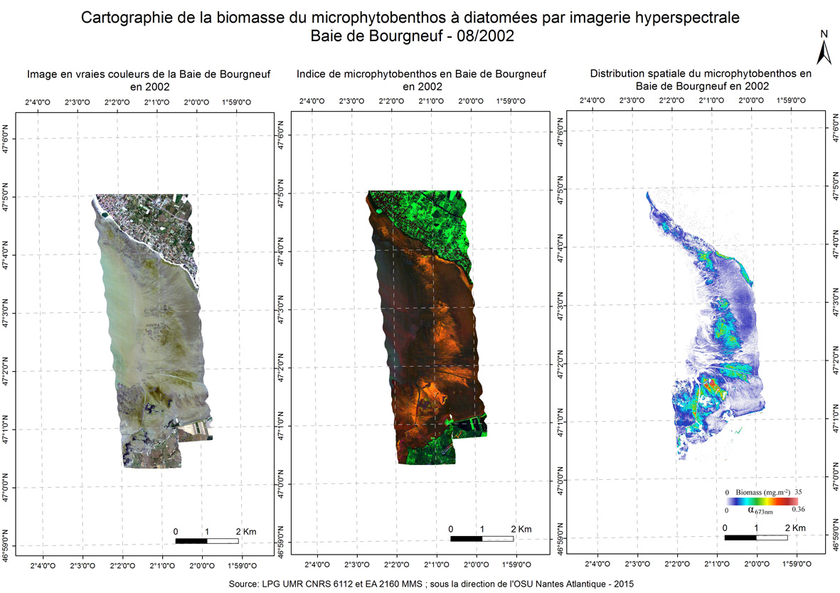
A new approach to mapping based on an optical model was developed and used from hyperspectral aerial images to determine the biofilm microphytobenthos and estimate their biomass in confined mudflats here in the Bay of Bourgneuf in 2002.
-
Modèle Numérique de Bathymétrie (MNB) obtenue à l'aide du suivi LiDAR de la côte vendéenne au nord de l’île de Noirmoutier