 Geopal
GeoTIFF
Domaines
Harvested
Provided by
Type of resources
Available actions
Topics
Keywords
Contact for the resource
Provided by
Years
Formats
Representation types
Update frequencies
status
Scale
Resolution
-
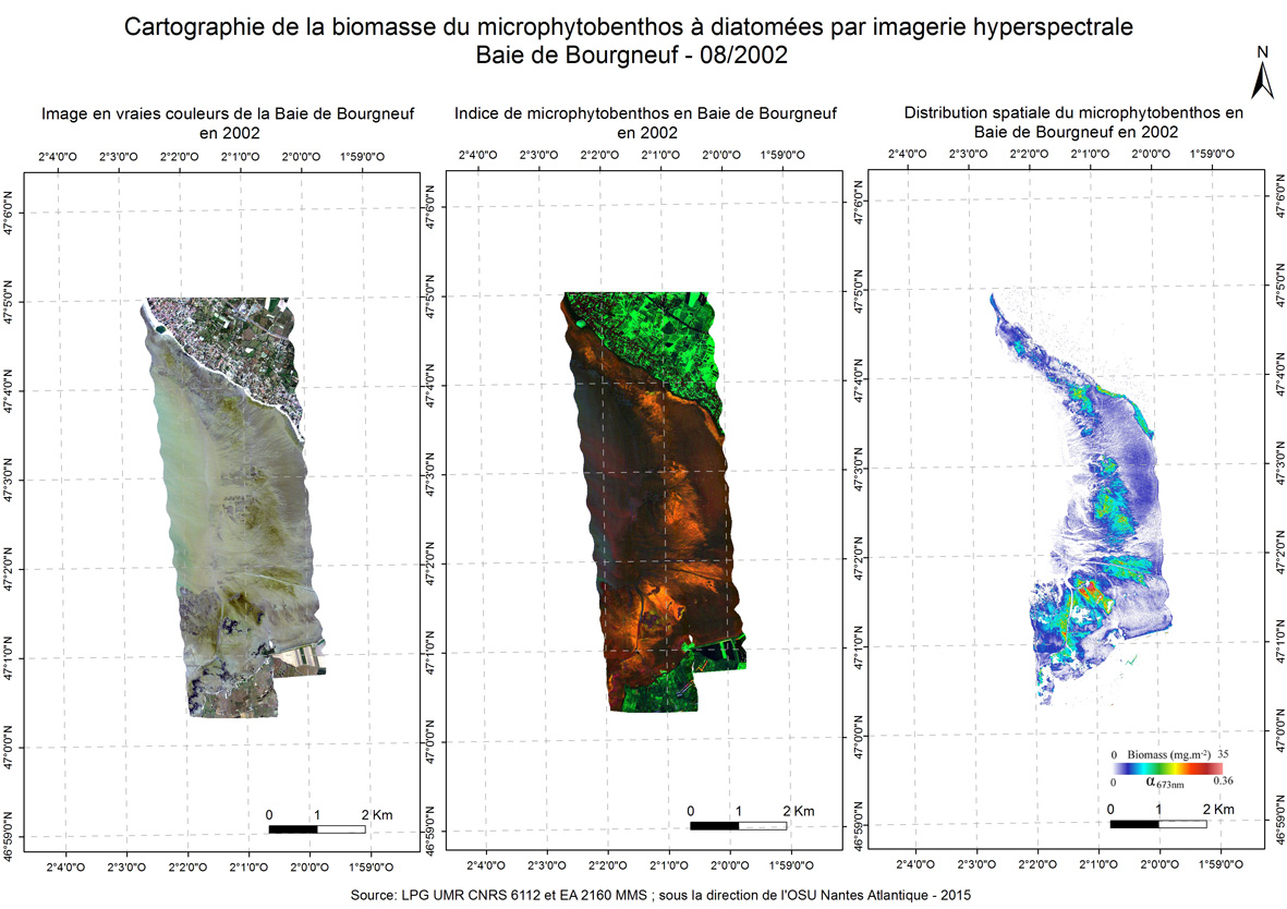
A new approach to mapping based on an optical model was developed and used from hyperspectral aerial images to determine the biofilm microphytobenthos and estimate their biomass in confined mudflats here in the Bay of Bourgneuf in 2002.
-
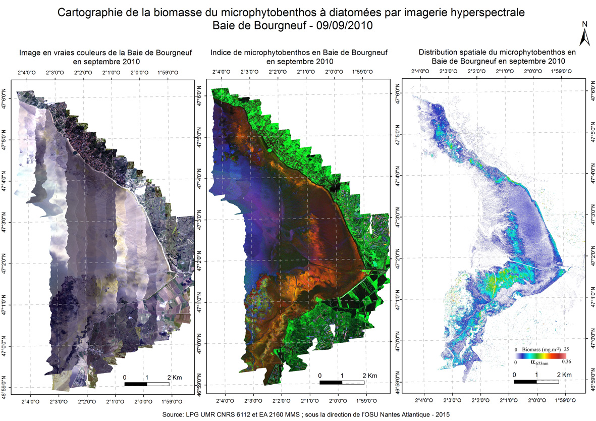
A new approach to mapping based on an optical model was developed and used from hyperspectral aerial images to determine the biofilm microphytobenthos and estimate their biomass in confined mudflats here in the Bay of Bourgneuf in 2010 september.
-
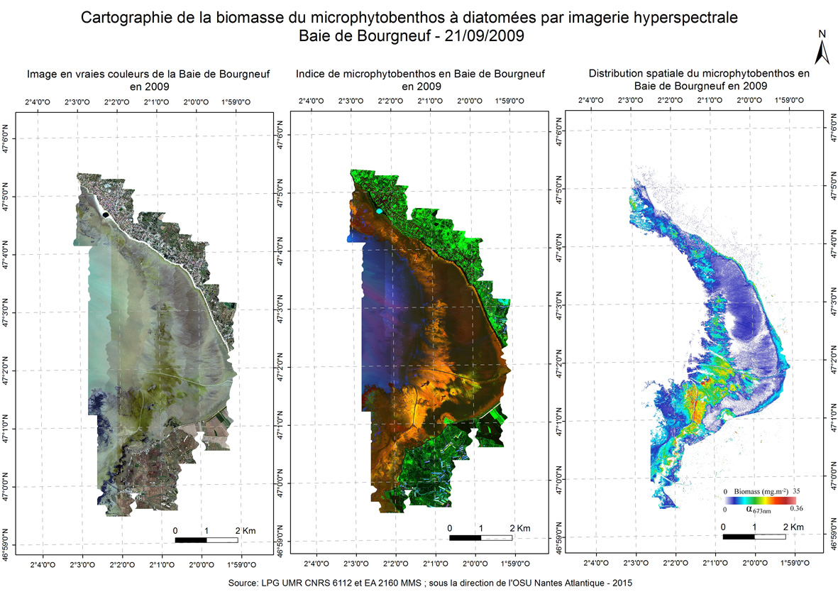
A new approach to mapping based on an optical model was developed and used from hyperspectral aerial images to determine the biofilm microphytobenthos and estimate their biomass in confined mudflats here in the Bay of Bourgneuf in 2009.
-
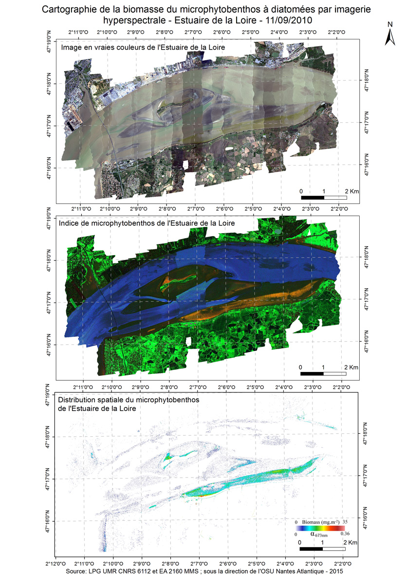
A new approach to mapping based on an optical model was developed and used from hyperspectral aerial images to determine the biofilm microphytobenthos and estimate their biomass in confined mudflats here in the Loire estuary in 2010.
-
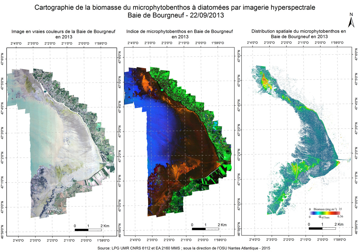
A new approach to mapping based on an optical model was developed and used from hyperspectral aerial images to determine the biofilm microphytobenthos and estimate their biomass in confined mudflats here in the Bay of Bourgneuf in 2013 september.
-
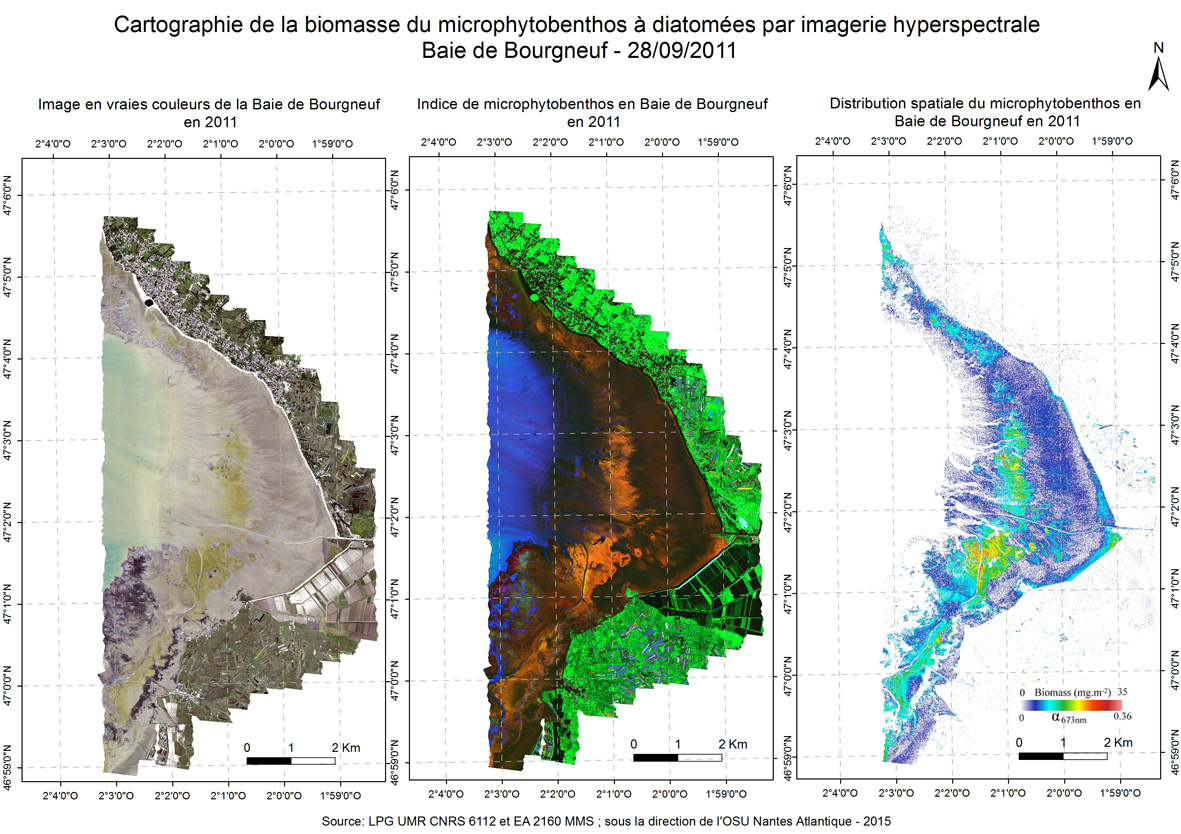
A new approach to mapping based on an optical model was developed and used from hyperspectral aerial images to determine the biofilm microphytobenthos and estimate their biomass in confined mudflats here in the Bay of Bourgneuf in 2011 september.
-
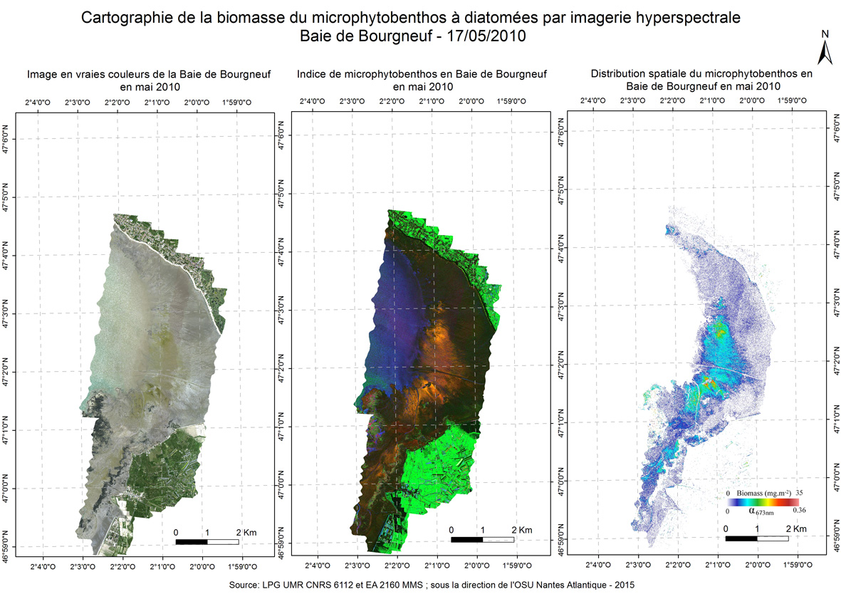
A new approach to mapping based on an optical model was developed and used from hyperspectral aerial images to determine the biofilm microphytobenthos and estimate their biomass in confined mudflats here in the Bay of Bourgneuf in may 2010.
-
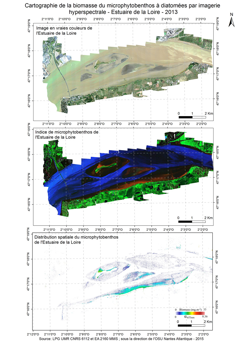
A new approach to mapping based on an optical model was developed and used from hyperspectral aerial images to determine the biofilm microphytobenthos and estimate their biomass in confined mudflats here in the Loire estuary in 2013.
-
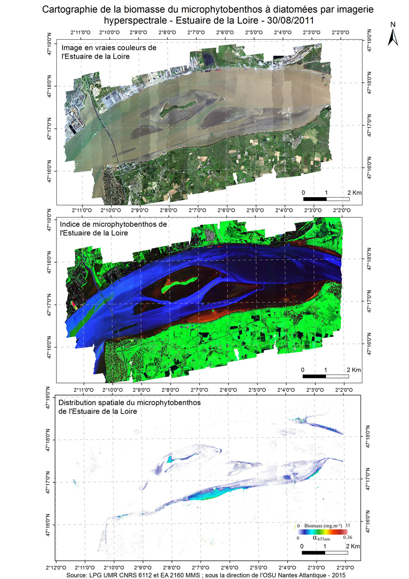
A new approach to mapping based on an optical model was developed and used from hyperspectral aerial images to determine the biofilm microphytobenthos and estimate their biomass in confined mudflats here in the Loire estuary in 2011.
-

Modèle Numérique de Terrain obtenu par LiDAR sur la côte vendéenne au niveau de Luzéronde