Keyword
multispectral image
Domaines
Harvested
Provided by
Type of resources
Available actions
Topics
Keywords
Contact for the resource
Provided by
Representation types
Update frequencies
status
From
1
-
1
/
1
-

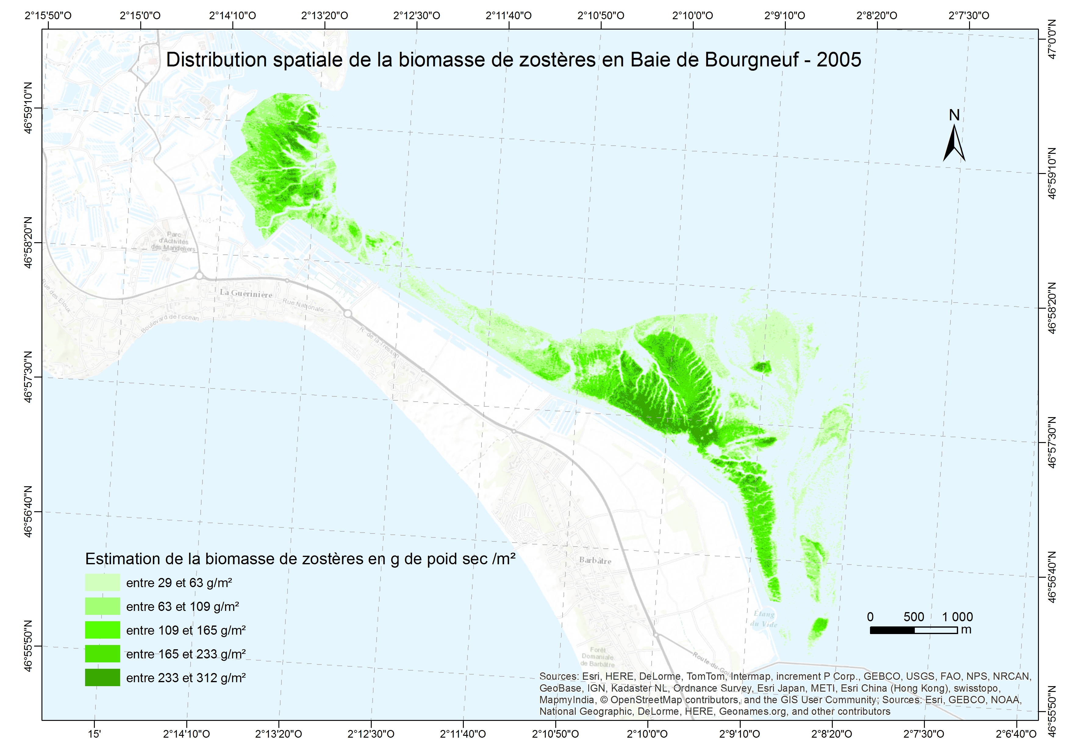
Exploring the feasibility of monitoring the evolution of the spatial distribution of intertidal eelgrass from multispectral images combined with measures spectroradiometric land in confined areas. This spatial distribution for the amount of intertidal eelgrass present through the calculation of a vegetation index . This vegetation index can then be connected to the biomass.
 Geopal